Thanks for keeping us posted. But can you please put this into the gunshot thread before the babies start whiningHound wrote: ↑Mon Mar 29, 2021 10:48 am My guess was right.
https://twitter.com/kbolan/status/1376587245629542400
March 2021 Forecasts and Discussions
-
Hawk

- Storm Chaser

- Posts: 7573
- Joined: Mon Feb 18, 2019 6:45 pm
- Location: Langley/The Similkameeeens
- Elevation: 320ft/3000ft
- Has thanked: 14343 times
- Been thanked: 7230 times
Re: March 2021 Forecasts and Discussions
May has arrived and it will be a GREAT month 
tell em Nito!!
Willoughby Langley at ~320ft / Similkameeeens ~3400ft
tell em Nito!!
Willoughby Langley at ~320ft / Similkameeeens ~3400ft
-
Hawk
- Storm Chaser
- Posts: 7573
- Joined: Mon Feb 18, 2019 6:45 pm
- Location: Langley/The Similkameeeens
- Elevation: 320ft/3000ft
- Has thanked: 14343 times
- Been thanked: 7230 times
Re: March 2021 Forecasts and Discussions
It looks like it's going to happen again. We seem to be in a #patternlock... every weekend we're getting a cold troff coming in followed by a midweek Ridge. This is the fourth or fifth one in a row. Will this last for 2 months like most #patternlocks usually do? That would lead to a relatively chilly spring mixed in with some nice Sunshine. I'll take it.
May has arrived and it will be a GREAT month
tell em Nito!!
Willoughby Langley at ~320ft / Similkameeeens ~3400ft
tell em Nito!!
Willoughby Langley at ~320ft / Similkameeeens ~3400ft
-
Hound

- Site Admin

- Posts: 4726
- Joined: Sun Feb 17, 2019 2:11 pm
- Location: Fraser Heights
- Has thanked: 30033 times
- Been thanked: 10184 times

-
SouthSardiswx

- Donator

- Posts: 21077
- Joined: Sun Feb 17, 2019 2:37 pm
- Location: Chilliwack (South Sardis)
- Has thanked: 56080 times
- Been thanked: 18247 times
Re: March 2021 Forecasts and Discussions
Last edited by SouthSardiswx on Mon Mar 29, 2021 7:19 pm, edited 1 time in total.
Join us next season for the 8th annual that's not accurate snowfall contest.
 Wrinkle Rockers: 15.0cm

 South Sardinies: 3.5cm
CYCW station
https://cycw.awos.live/local-weather
CYCW station
https://cycw.awos.live/local-weather
-
SouthSardiswx
- Donator
- Posts: 21077
- Joined: Sun Feb 17, 2019 2:37 pm
- Location: Chilliwack (South Sardis)
- Has thanked: 56080 times
- Been thanked: 18247 times
Re: March 2021 Forecasts and Discussions

Join us next season for the 8th annual that's not accurate snowfall contest.
Wrinkle Rockers: 15.0cm
South Sardinies: 3.5cm
CYCW station
https://cycw.awos.live/local-weather
CYCW station
https://cycw.awos.live/local-weather
-
SouthSardiswx
- Donator
- Posts: 21077
- Joined: Sun Feb 17, 2019 2:37 pm
- Location: Chilliwack (South Sardis)
- Has thanked: 56080 times
- Been thanked: 18247 times
Re: March 2021 Forecasts and Discussions
l seldom used it l use the Weather Canada app. much better.
Join us next season for the 8th annual that's not accurate snowfall contest.
Wrinkle Rockers: 15.0cm
South Sardinies: 3.5cm
CYCW station
https://cycw.awos.live/local-weather
CYCW station
https://cycw.awos.live/local-weather
-
PortKells
- Storm Chaser
- Posts: 7123
- Joined: Sun Feb 17, 2019 4:08 pm
- Location: Port Kells
- Elevation: 78m
- Has thanked: 576 times
- Been thanked: 12516 times
Re: March 2021 Forecasts and Discussions
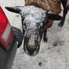
Sasquatch's snowpack is unbelievable. 5 meters and still growing. Great powder day today too. Drove through a quick snow squall after getting off the mountain, basically at sea level.
-
Hawk
- Storm Chaser
- Posts: 7573
- Joined: Mon Feb 18, 2019 6:45 pm
- Location: Langley/The Similkameeeens
- Elevation: 320ft/3000ft
- Has thanked: 14343 times
- Been thanked: 7230 times
Re: March 2021 Forecasts and Discussions
Awesome day then?
May has arrived and it will be a GREAT month
tell em Nito!!
Willoughby Langley at ~320ft / Similkameeeens ~3400ft
tell em Nito!!
Willoughby Langley at ~320ft / Similkameeeens ~3400ft
-
Rubus_Leucodermis

- Storm Chaser
- Posts: 5714
- Joined: Thu Nov 21, 2019 5:48 pm
- Location: Vancouver
- Elevation: 70 m / 230 ft
- Has thanked: 4636 times
- Been thanked: 11642 times
Re: March 2021 Forecasts and Discussions
Fail indeed.
Is there any other option? I know the University of Washington had a radar site, but as of the last time I checked it didn’t incorporate Canadian data, which is/was a pretty big minus. If there’s integrated North American data being generated now, my hope would be there is some better alternative for visualizing it.
It's called clown range for a reason.
-
Hawk
- Storm Chaser
- Posts: 7573
- Joined: Mon Feb 18, 2019 6:45 pm
- Location: Langley/The Similkameeeens
- Elevation: 320ft/3000ft
- Has thanked: 14343 times
- Been thanked: 7230 times
Re: March 2021 Forecasts and Discussions
Today was a cool troffy day with N / NW flow. There was some nice pop up showers mainly along the mountains that were falling mainly as snow with very low dew points. Today was one of those days where it could have been 10C and sunny and then an hour later 5c or 6C with some wet snow falling. Right Nito? 
May has arrived and it will be a GREAT month
tell em Nito!!
Willoughby Langley at ~320ft / Similkameeeens ~3400ft
tell em Nito!!
Willoughby Langley at ~320ft / Similkameeeens ~3400ft
-
SouthSardiswx
- Donator
- Posts: 21077
- Joined: Sun Feb 17, 2019 2:37 pm
- Location: Chilliwack (South Sardis)
- Has thanked: 56080 times
- Been thanked: 18247 times
Re: March 2021 Forecasts and Discussions
l thought the UW radar incorporated our radar up here in Aldergrove?Rubus_Leucodermis wrote: ↑Mon Mar 29, 2021 8:13 pm Fail indeed.
Is there any other option? I know the University of Washington had a radar site, but as of the last time I checked it didn’t incorporate Canadian data, which is/was a pretty big minus. If there’s integrated North American data being generated now, my hope would be there is some better alternative for visualizing it.
Join us next season for the 8th annual that's not accurate snowfall contest.
Wrinkle Rockers: 15.0cm
South Sardinies: 3.5cm
CYCW station
https://cycw.awos.live/local-weather
CYCW station
https://cycw.awos.live/local-weather
-
Hawk
- Storm Chaser
- Posts: 7573
- Joined: Mon Feb 18, 2019 6:45 pm
- Location: Langley/The Similkameeeens
- Elevation: 320ft/3000ft
- Has thanked: 14343 times
- Been thanked: 7230 times
Re: March 2021 Forecasts and Discussions
May has arrived and it will be a GREAT month
tell em Nito!!
Willoughby Langley at ~320ft / Similkameeeens ~3400ft
tell em Nito!!
Willoughby Langley at ~320ft / Similkameeeens ~3400ft
-
Hawk
- Storm Chaser
- Posts: 7573
- Joined: Mon Feb 18, 2019 6:45 pm
- Location: Langley/The Similkameeeens
- Elevation: 320ft/3000ft
- Has thanked: 14343 times
- Been thanked: 7230 times
Re: March 2021 Forecasts and Discussions
Looks like another impressive troff for the weekend. What will this one bring? 
Last one sucked as lower snow levels never materialized ..the previous troff was actually better for that.
Last one sucked as lower snow levels never materialized
May has arrived and it will be a GREAT month
tell em Nito!!
Willoughby Langley at ~320ft / Similkameeeens ~3400ft
tell em Nito!!
Willoughby Langley at ~320ft / Similkameeeens ~3400ft
-
stuffradio
- Site Admin
- Posts: 2659
- Joined: Sun Feb 17, 2019 2:07 pm
- Location: Maple Ridge
- Has thanked: 4184 times
- Been thanked: 6467 times
- Contact:
-
VanCitySouth
- Weather Enthusiast

- Posts: 3910
- Joined: Sun Feb 17, 2019 2:21 pm
- Location: Vancouver (Langara)
- Elevation: 72 m/236 ft
- Has thanked: 4157 times
- Been thanked: 8296 times
Re: March 2021 Forecasts and Discussions
Nito cursed us. He kept saying it would be a cold and wet spring and that winter would set up too late.Hawk wrote: ↑Mon Mar 29, 2021 5:33 pm
It looks like it's going to happen again. We seem to be in a #patternlock... every weekend we're getting a cold troff coming in followed by a midweek Ridge. This is the fourth or fifth one in a row. Will this last for 2 months like most #patternlocks usually do? That would lead to a relatively chilly spring mixed in with some nice Sunshine. I'll take it.
2024-25 season stats:
Climo 65 to 25
  GFS
GFS
Season total: 22 cm
Climo
Season total: 22 cm