00z GFS ensembles:
00z ECMWF ensembles:
00z GEM ensembles:
----------------------------------------------------------------------------------
January 2025 Forecasts And Discussions
-
Typeing3
- Weather Psycho

- Posts: 13108
- Joined: Sun Feb 17, 2019 3:02 pm
- Location: Coquitlam
- Elevation: 25M./80Ft.
- Has thanked: 23598 times
- Been thanked: 25528 times
Re: January 2025 Forecasts And Discussions
You do not have the required permissions to view the files attached to this post.
East Coquitlam
Elevation 25M (80Ft)
#MrJanuary
-
Typeing3
- Weather Psycho
- Posts: 13108
- Joined: Sun Feb 17, 2019 3:02 pm
- Location: Coquitlam
- Elevation: 25M./80Ft.
- Has thanked: 23598 times
- Been thanked: 25528 times
Re: January 2025 Forecasts And Discussions
06z GFS
Day 5 to Day 13
North Pacific blocking!
Day 5 to Day 13
North Pacific blocking!
You do not have the required permissions to view the files attached to this post.
East Coquitlam
Elevation 25M (80Ft)
#MrJanuary
-
PortKells
- Storm Chaser

- Posts: 7096
- Joined: Sun Feb 17, 2019 4:08 pm
- Location: Port Kells
- Elevation: 78m
- Has thanked: 576 times
- Been thanked: 12444 times
Re: January 2025 Forecasts And Discussions
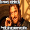
For the oreganos maybe. Looks perfect for BC. I demand Nito explain this!SouthSardiswx wrote: ↑Mon Jan 27, 2025 3:56 am Looks like the rug pull has begun
pulling_the_rug_out.jpg
-
PortKells
- Storm Chaser
- Posts: 7096
- Joined: Sun Feb 17, 2019 4:08 pm
- Location: Port Kells
- Elevation: 78m
- Has thanked: 576 times
- Been thanked: 12444 times
Re: January 2025 Forecasts And Discussions
Feb 2017!
You do not have the required permissions to view the files attached to this post.
-
wetcoast91

- Storm Chaser
- Posts: 6553
- Joined: Sun Feb 17, 2019 3:12 pm
- Location: New Westminster
- Elevation: 106m
- Has thanked: 6481 times
- Been thanked: 15065 times
Re: January 2025 Forecasts And Discussions
It's kind of a case where you don't want a deep arctic airmass if you prefer snow over cold. Recent runs are a fine balance that delivers +0C wet snow.
Some ensemble runs really dig that trough which brings in the cold but keeps all shower activity in Oregon and SW Washington.
Some ensemble runs really dig that trough which brings in the cold but keeps all shower activity in Oregon and SW Washington.
-
stuffradio
- Site Admin

- Posts: 2514
- Joined: Sun Feb 17, 2019 2:07 pm
- Location: Maple Ridge
- Has thanked: 3995 times
- Been thanked: 6147 times
- Contact:
Re: January 2025 Forecasts And Discussions
Some of our heaviest snows are around -1 to 1C.wetcoast91 wrote: ↑Mon Jan 27, 2025 7:32 am It's kind of a case where you don't want a deep arctic airmass if you prefer snow over cold. Recent runs are a fine balance that delivers +0C wet snow.
Some ensemble runs really dig that trough which brings in the cold but keeps all shower activity in Oregon and SW Washington.
-
PortKells
- Storm Chaser
- Posts: 7096
- Joined: Sun Feb 17, 2019 4:08 pm
- Location: Port Kells
- Elevation: 78m
- Has thanked: 576 times
- Been thanked: 12444 times
Re: January 2025 Forecasts And Discussions
Hopefully not a case of being in the sweet spot too early like Jan 2011. Gives me some pause.wetcoast91 wrote: ↑Mon Jan 27, 2025 7:32 am It's kind of a case where you don't want a deep arctic airmass if you prefer snow over cold. Recent runs are a fine balance that delivers +0C wet snow.
Some ensemble runs really dig that trough which brings in the cold but keeps all shower activity in Oregon and SW Washington.
-
tyweather

- Model Rider

- Posts: 1654
- Joined: Sun Feb 17, 2019 2:39 pm
- Location: Newton, Surrey, EL. 70m
- Has thanked: 71 times
- Been thanked: 3757 times
Re: January 2025 Forecasts And Discussions
I am looking forward to the local hills finally fully opening up.
Why not try cycling to work, grocery store, anywhere!
-
Rubus_Leucodermis

- Storm Chaser
- Posts: 5644
- Joined: Thu Nov 21, 2019 5:48 pm
- Location: Vancouver
- Elevation: 70 m / 230 ft
- Has thanked: 4611 times
- Been thanked: 11477 times
Re: January 2025 Forecasts And Discussions
The string of -4’s continues. -4.1˚C this morning.
It's called clown range for a reason.
-
Rubus_Leucodermis
- Storm Chaser
- Posts: 5644
- Joined: Thu Nov 21, 2019 5:48 pm
- Location: Vancouver
- Elevation: 70 m / 230 ft
- Has thanked: 4611 times
- Been thanked: 11477 times
Re: January 2025 Forecasts And Discussions
It’s one of the easiest ways we get a snowfail instead of a snowfall here: too much cold air, tumbleweeds here, all the snowy fun caused by cold air clashing with moist marine air stays well to our south. Weaker blasts tend to be better for us if you want snow.wetcoast91 wrote: ↑Mon Jan 27, 2025 7:32 am It's kind of a case where you don't want a deep arctic airmass if you prefer snow over cold. Recent runs are a fine balance that delivers +0C wet snow.
Some ensemble runs really dig that trough which brings in the cold but keeps all shower activity in Oregon and SW Washington.
It's called clown range for a reason.
-
wetcoast91
- Storm Chaser
- Posts: 6553
- Joined: Sun Feb 17, 2019 3:12 pm
- Location: New Westminster
- Elevation: 106m
- Has thanked: 6481 times
- Been thanked: 15065 times
Re: January 2025 Forecasts And Discussions
Orientation of the trough favours heavier snow showers for Western Vancouver Island and Eastern Fraser Valley. This GFS run makes me feel that 10-15cm could be a good bet on Saturday-Sunday.
Probably a scenario where Eastern Vancouver Island remains bone dry and Metro Vancouver sees periodic slushy showers that don't accumulate to much.
Looks better on Sunday Evening as the arctic outflow kicks up but the Lower Mainland dries out.
Probably a scenario where Eastern Vancouver Island remains bone dry and Metro Vancouver sees periodic slushy showers that don't accumulate to much.
Looks better on Sunday Evening as the arctic outflow kicks up but the Lower Mainland dries out.
-
Rubus_Leucodermis
- Storm Chaser
- Posts: 5644
- Joined: Thu Nov 21, 2019 5:48 pm
- Location: Vancouver
- Elevation: 70 m / 230 ft
- Has thanked: 4611 times
- Been thanked: 11477 times
Re: January 2025 Forecasts And Discussions
Ensemble mean dipping below the -7˚C mark in all three, but six days out. If it’s sticking to the same schedule tomorrow, it will be five days out, finally inside the believable range and worth starting to get excited about.Typeing3 wrote: ↑Mon Jan 27, 2025 6:37 am 00z GFS ensembles:
ens_image.png
00z ECMWF ensembles:
ens_image (1).png
00z GEM ensembles:
ens_image (2).png
----------------------------------------------------------------------------------
20250127142104-4d42c169d51b210058818100a31d70e6937452fe.png
20250127142050-4ca095758e877a6b8e1f8a73bd20600c9fd1325e.png
It's called clown range for a reason.
-
SouthSardiswx
- Donator

- Posts: 20586
- Joined: Sun Feb 17, 2019 2:37 pm
- Location: Chilliwack (South Sardis)
- Has thanked: 55202 times
- Been thanked: 17703 times
Re: January 2025 Forecasts And Discussions
Any idea how far south the modified Arctic air drops are we talking another Seattle skunker.Rubus_Leucodermis wrote: ↑Mon Jan 27, 2025 8:18 am Ensemble mean dipping below the -7˚C mark in all three, but six days out. If it’s sticking to the same schedule tomorrow, it will be five days out, finally inside the believable range and worth starting to get excited about.
You do not have the required permissions to view the files attached to this post.
The 7th annual snowfall contest is about to begin stay tuned
 Wrinkle Rockers: 15.0cm
 South Sardinies: 3.5cm
CYCW station
https://cycw.awos.live/local-weather
CYCW station
https://cycw.awos.live/local-weather
-
Radar
- Weather Fanatic

- Posts: 860
- Joined: Sun Feb 17, 2019 7:23 pm
- Location: West Abbotsford
- Elevation: 290ft
- Has thanked: 36 times
- Been thanked: 1601 times
Re: January 2025 Forecasts And Discussions
Don't forget the rug pull later today on things. End up with showers and highs of 4. hahaha.wetcoast91 wrote: ↑Mon Jan 27, 2025 8:14 am Orientation of the trough favours heavier snow showers for Western Vancouver Island and Eastern Fraser Valley. This GFS run makes me feel that 10-15cm could be a good bet on Saturday-Sunday.
Probably a scenario where Eastern Vancouver Island remains bone dry and Metro Vancouver sees periodic slushy showers that don't accumulate to much.
Looks better on Sunday Evening as the arctic outflow kicks up but the Lower Mainland dries out.
West Abby. Elev. 290ft
PWS: https://www.wunderground.com/dashboard/pws/IABBOT57/
24/25 snow total: 29cm
PWS: https://www.wunderground.com/dashboard/pws/IABBOT57/
24/25 snow total: 29cm
-
Hawk

- Storm Chaser
- Posts: 7460
- Joined: Mon Feb 18, 2019 6:45 pm
- Location: Langley/The Similkameeeens
- Elevation: 320ft/3000ft
- Has thanked: 14117 times
- Been thanked: 7081 times
Re: January 2025 Forecasts And Discussions
It seems to me that these fake cold periods often lead to favourable winter conditions and snow 
#patternshift mid Jan leads to  #beginningofFeb...again.
Willoughby Langley at ~320ft / Similkameeeens ~3400ft
Willoughby Langley at ~320ft / Similkameeeens ~3400ft